SUBJECT: PAPA`A BEACH ACCESS
SOURCE: JUAN WILSON juanwilson@mac.com
POSTED: 12 October 2004 - 12:00pm
Is there a second access to Papaa Beach on the county tax maps?
 |
by
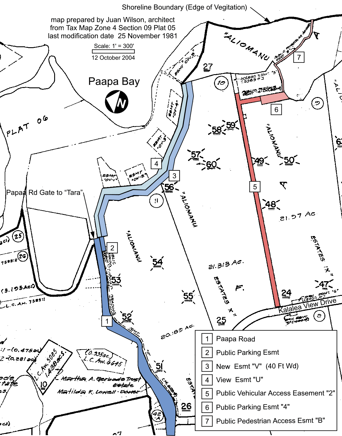
Juan Wilson 12 October 2004 The Red Access begins with with a Vehicular Access Easement "2" that is labelled [5] on the map below and directly connected to Kalalea View Drive. Off the vehicular access is a Public parking Esmt "4" that is labelled [6] on the map. Directly from this parking is "Public Pedestrian Access Esmt "B" that is labelled [7] on map. Note that the pedestrian easement appears to be about ten feet wide and extend to the "Shoreline Boundary". The Blue Access begins with Paapa Road that is accessed directly from the Kuhio Highway. Paapa Road lableled [1] is identified as a public road. At the north-east end of Paapa Road is a gate defining the bounday of the "Tara" estate. Immediately to the right of the gate the Tax Map identifies a "Public Parking Esmt" of 1,700sf (enough for 6 cars). This area is labeled [2] on the map. Stretch from this Public Parking to the Shoreline Boundary (edge of vegitation) is an area labeled "View Esmt 'U'" that appears to be about 30 feet wide. Directly mauka (inland) of the View Easement is an area labeled "New Esmt 'V' (40 ft wd)".
There appears to be an intent to show a public easement that would take visitiors from the end of Paapa Road to a parking lot and along a 70 foot wide easement 1400 feet down to the Shoreline Boundary (edge of vegitation). If this is not a beach access I can't imagine why it is shown on the map. The 40 foot wide New Easement is wide enough to accommodate vehicular traffic. A field investigation seems to be in order. |
Pau